
Trip Durations
14 Days

Quick Contact
4.9  | 14 Days | Kathmandu - Manaslu Region - Kathmandu
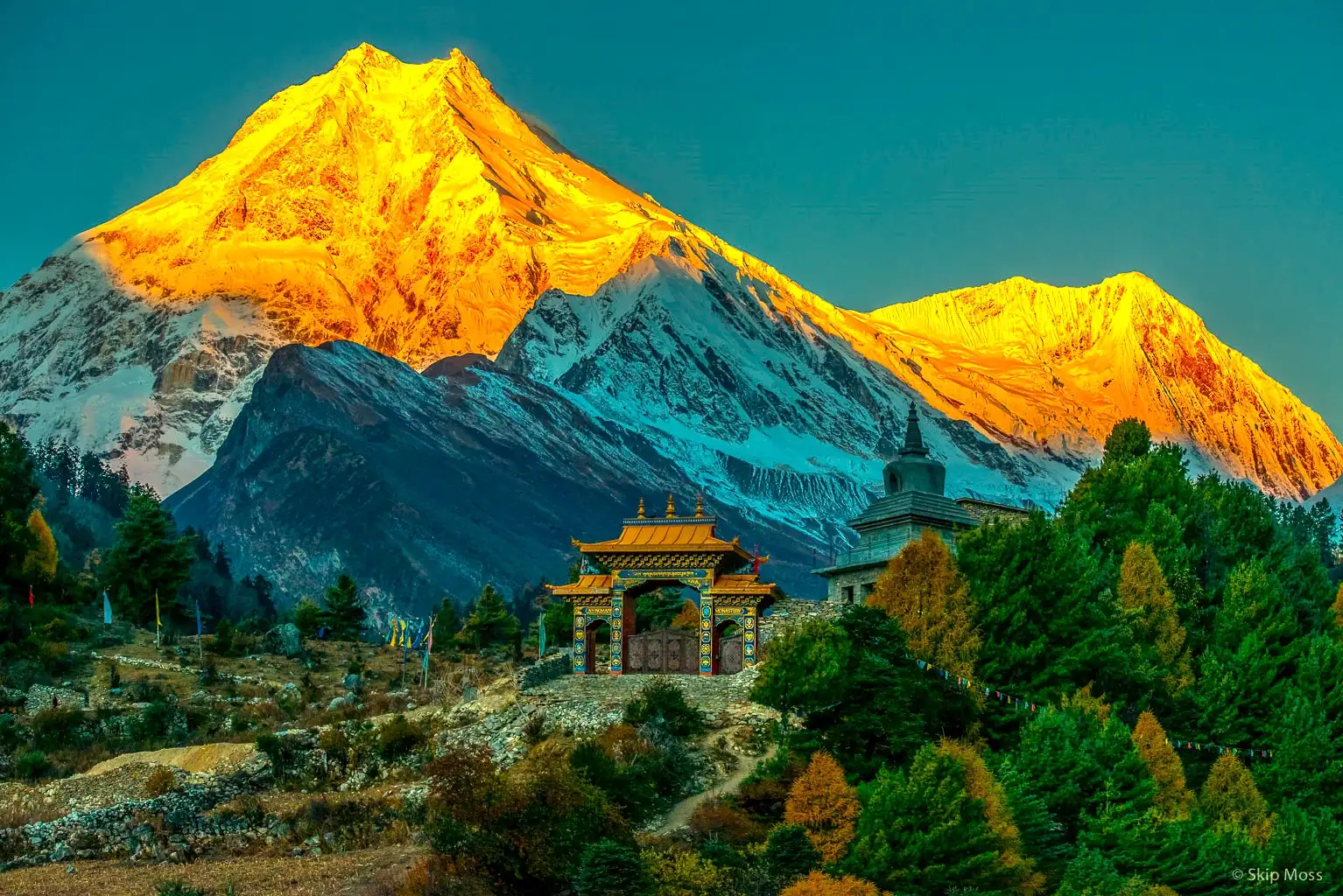
The Manaslu Circuit Trek is a teahouse trek in Nepal that circles Manaslu (8,163 m), the world’s eighth-highest mountain. The route follows the Budhi Gandaki gorge, passes Tibetan-style villages near the Tibet border, and crosses the Larkya La Pass (5,106 m). It covers six climate zones in about ten days of walking and is much quieter than the Everest and Annapurna trails.
| Item | Detail |
|---|---|
| Main mountain | Manaslu (8,163 m), 8th highest on Earth |
| Highest point | Larkya La Pass, 5,106 m |
| Walking days | About 10 |
| Climate zones | 6, from rice terraces to glaciers |
| Key villages | Samagaun, Samdo |
| Rest-day hikes | Pungyen Gompa or Manaslu Base Camp |
| Wildlife | Himalayan tahr, blue sheep, rare snow leopard signs |
| Crowds | Far fewer trekkers than Everest or Annapurna |
The Manaslu Circuit Trek 14 Days is a challenging Himalayan journey around Mount Manaslu, the world's eighth-highest mountain at 8,163 m. The route takes trekkers from the lower Budhi Gandaki valley through forests, dramatic river gorges, traditional mountain settlements and Tibetan-influenced villages before reaching the high alpine landscape of the Manaslu region.
The highlight of this 14 Days Manaslu Circuit Trek is crossing Larkya La Pass at 5,106 m, followed by the descent toward Bimthang and Dharapani. The trek combines spectacular mountain scenery, remote villages, Buddhist culture, suspension bridges, monasteries and varied landscapes in one remote Himalayan adventure.
The itinerary includes an acclimatization day around Samagaon, helping trekkers prepare for the higher elevations ahead. Depending on weather, trail conditions and group fitness, the acclimatization day can include a side hike toward Birendra Lake, Pungyen Gompa or Manaslu Base Camp.
Walk all the way around Mount Manaslu (8,163 m), the world's eighth-highest mountain, in 14 days — from the subtropical gorge of the Budhi Gandaki to the 5,106 m Larkya La Pass. This is the Himalaya the way Annapurna and Everest felt 30 years ago: quiet trails, stone villages, prayer flags and Tibetan Buddhist monasteries, with far fewer trekkers on the path.
Because Manaslu is a restricted area, every trekker travels with a licensed guide and a special permit. That keeps crowds small and the culture of the Nubri and Tsum people intact. With Nepal Trekking Trail, we arrange every permit, every lodge and every transfer, so you only have to walk, look up and breathe.
| Trip Facts | Details |
|---|---|
| Trip Name | Manaslu Circuit Trek |
| Duration | 14 Days |
| Difficulty | Challenging |
| Max. Altitude | 5,106 m |
| Highest Point | Larkya La Pass |
| Accommodation | Hotels in Kathmandu and teahouses/lodges during the trek |
| Best Season | March–May and September–November |
| Transportation | Private/shared road transportation and trekking |
| Trek Region | Manaslu Region |
| Trek Type | Circuit Trek |
| Starting Point | Kathmandu |
| Trek Starting Point | Machha Khola / Soti Khola area |
| Ending Point | Dharapani |
| Final Destination | Kathmandu |
| Main Attraction | Larkya La Pass and Mount Manaslu |
| Trek Highlights | Remote Himalayan adventure, Tibetan-influenced villages, mountain scenery and high-pass crossing |
| No. | Village | Elevation | People | Role on the Trek | Overview | Interesting Points |
|---|---|---|---|---|---|---|
| 1 | Arughat Bazaar | about 570 m | Mixed hill communities | Market town on the drive in | Busy bazaar town split by the Budhi Gandaki between Gorkha and Dhading districts; last proper market before the trail | Last stop for snacks, batteries and cash; first view of the Budhi Gandaki |
| 2 | Soti Khola | about 710 m | Gurung, Magar and others | Traditional trailhead and first overnight stop | Riverside village where the road once ended and walking began | Warm subtropical setting with sal forest, bananas and terraces |
| 3 | Lapubesi | about 880 m | Gurung | Trail village | Gurung village perched on the hillside above the gorge | Dramatic gorge views; classic Gurung stone houses |
| 4 | Machha Khola | about 930 m | Gurung and mixed | Common first night on the trail | Name means "fish river"; riverside village with good teahouses | Often the first teahouse night; jeeps reach here in the dry season |
| 5 | Khorlabesi | about 970 m | Gurung | Trail village | Peaceful farming village among rice, millet and maize terraces | Good view of traditional farming life; tea or lunch stop |
| 6 | Tatopani | about 990 m | Mixed | Lunch or rest stop | Name means "hot water"; natural hot springs piped into taps | One of the few hot springs on the circuit; great for a quick wash |
| 7 | Dobhan | about 1,070 m | Mixed | Trail village | Name means "confluence"; valley narrows here | Powerful rapids, suspension bridges and rocky trail sections |
| 8 | Yaru Khola | about 1,170 m | Mixed | Trail stop | Small settlement on the way to Jagat | Some of the most impressive waterfalls in the lower valley |
| 9 | Jagat | about 1,340 m | Gurung and mixed | Restricted area and conservation area entry checkpoint | Permits checked and municipality fee collected; neat stone houses | Flagstone-paved streets; official start of the restricted area |
| 10 | Salleri | about 1,440 m | Mixed | Trail village | Small village just above Jagat with terraces and open hillsides | Often the first distant view of Shringi Himal |
| 11 | Sirdibas | about 1,420 m | Mixed | Trail village | First signs of Tibetan Buddhist culture | First mani walls and prayer flags; Tsum permit days counted from around here |
| 12 | Philim | about 1,570 m | Gurung | Overnight stop | Large, prosperous village with a school, teahouses and Naksa Chhyoling Gompa | One of the larger lower-valley villages; the gorge deepens beyond |
| 13 | Ekle Bhatti | about 1,600 m | Mixed | Trail stop and Tsum Valley junction area | Name means "single inn"; small cluster of lodges | Steep, narrow gorge; Tsum trekkers split off toward Lokpa |
| No. | Village | Elevation | People | Role on the Trek | Overview | Interesting Points |
|---|---|---|---|---|---|---|
| 14 | Deng | about 1,860 m | Kutang and Nubri | Overnight stop | Start of the upper valley's Tibetan-influenced culture; bamboo forest | Clear cultural shift from Hindu to Buddhist; langur monkeys and birdlife |
| 15 | Rana | about 1,910 m | Nubri | Trail village | Small village across the river from Deng | Quiet and rural; valley views begin to open |
| 16 | Bihi Phedi | about 1,990 m | Nubri | Trail village and lunch stop | At the foot of the hillside village of Bihi | Beautifully carved mani stones along the trail |
| 17 | Ghap | about 2,160 m | Nubri | Trail village | Known for long mani walls and carved prayer stones | Some of the finest carvings on the route; rhododendron, pine and oak forest |
| 18 | Prok | about 2,400 m | Nubri | Optional detour across the river | Traditional village on a plateau with views of Shringi Himal | Side trip to Kal Tal lake and Kal Chhokang Gompa; few visitors |
| 19 | Namrung | about 2,630 m | Nubri | Overnight stop and permit checkpoint | Well-developed village with good teahouses and Namla Gompa | First good views of Manaslu, Siringi and Ganesh Himal |
| No. | Village | Elevation | People | Role on the Trek | Overview | Interesting Points |
|---|---|---|---|---|---|---|
| 20 | Lihi | about 2,920 m | Nubri | Trail village | Traditional village with barley fields and a kani (gateway chorten) | Side hike of about 2 hours to Hinang Gompa |
| 21 | Sho | about 2,960 m | Nubri | Trail village | Small village with chortens, prayer wheels and mani walls | Views of Naike Peak and Manaslu North |
| 22 | Lho | about 3,180 m | Nubri | Overnight stop | One of the most photogenic villages, with Ribung Gompa on the hill above | Iconic sunrise view of Manaslu's twin summits behind the monastery |
| 23 | Shyala | about 3,500 m | Nubri | Trail village | Wide valley ringed by Himal Chuli, Peak 29 and Manaslu | One of the widest panoramas on the route; yak pastures and potato fields |
| 24 | Samagaun | about 3,530 m | Nubri | Main acclimatization stop | Largest village in the upper valley and cultural center of Nubri; Sama Gompa and a health post | Side trips to Pungyen Gompa, Birendra Tal and Manaslu Base Camp (about 4,800 m); Tiji festival usually in May |
| 25 | Samdo | about 3,875 m | Tibetan-origin families | Second acclimatization stop | High, windswept village near the Tibetan border; historic trade stop | Hikes toward the border or up the ridge; yak herds everywhere |
| 26 | Dharamsala (Larkya Phedi) | about 4,460 m | None (lodges only) | Last stop before the pass | Small group of basic lodges at the foot of Larkya La | Pass day starts here around 3 or 4 a.m.; beds limited in peak season |
| — | Larkya La Pass | 5,106 m | — | High point of the trek | Prayer-flag-covered pass surrounded by glaciers | Views of Himlung Himal, Cheo Himal, Kang Guru and Annapurna II; long, steep descent |
| No. | Village | Elevation | People | Role on the Trek | Overview | Interesting Points |
|---|---|---|---|---|---|---|
| 27 | Bimthang | about 3,720 m | Seasonal lodges | Overnight stop after the pass | Wide meadow surrounded by mountains and glaciers; former Tibetan trading post | Superb views of Himlung, Cheo Himal and Manaslu's west face; Salpudanda glacier nearby |
| 28 | Karche | about 2,700 m | Mixed | Trail village | Small settlement in the forest along the Dudh Khola | Rhododendron, pine and birch forest, beautiful in spring |
| 29 | Gho | about 2,515 m | Gurung | Trail village | Quiet farming village with barley and potato fields | Quiet overnight alternative to Tilije |
| 30 | Tilije | about 2,300 m | Gurung | Overnight stop | Large village with stone houses, narrow lanes and many teahouses | Known for local barley and apple products; popular post-pass celebration stop |
| 31 | Thonje | about 1,965 m | Gurung | Trail village and checkpoint | At the meeting of the Dudh Khola and Marsyangdi River; small gompa | Where the Manaslu trail joins the Annapurna Circuit area |
| 32 | Dharapani | about 1,860 m | Mixed | End of the trek | Busy village on the Annapurna Circuit road with an ACAP checkpoint | Jeeps to Besisahar, then Kathmandu or Pokhara; option to continue the Annapurna Circuit |
| Village | Elevation | Overview | Interesting Points |
|---|---|---|---|
| Lokpa | about 2,240 m | First village in the Tsum Valley, with a few simple lodges | Gateway to the "hidden valley" |
| Chumling | about 2,386 m | Traditional village in lower Tsum with stone houses and terraces | Old gompas and views of Shringi Himal |
| Chhekampar | about 3,031 m | Largest village in upper Tsum and its cultural center | A few hours' walk to Rachen Gompa, a large nunnery |
| Nile | about 3,361 m | High Tsumba village with Tibetan-style houses | Gonhgye Gompa nearby |
| Chule | about 3,347 m | Village across the river from Nile | Base for visiting Mu Gompa, near the Tibetan border |
Altitude: 930 m
Driving Time: 8–10 hours
Distance: Approximately 160 km
Accommodation: Teahouse/Lodge
Meals: Lunch and Dinner
Your Manaslu Circuit Trek begins with an early morning drive from Kathmandu toward Machha Khola. The journey follows the Prithvi Highway before turning toward the Gorkha and Manaslu region. The road gradually enters the hills, passing through small settlements, terraced farmland, rivers and green valleys.
As you approach Machha Khola, the road becomes narrower and more rugged. Machha Khola is located along the Budhi Gandaki River and serves as the starting point for the main trekking section.
Highlights: Kathmandu Valley, Trishuli River, rural Nepal, Budhi Gandaki River and mountain villages.
Overnight: Machha Khola
Altitude: 1,340 m
Walking Time: 6–7 hours
Distance: Approximately 22 km
Accommodation: Teahouse/Lodge
Meals: Breakfast, Lunch and Dinner
After breakfast, begin walking along the Budhi Gandaki River. The trail crosses several suspension bridges and passes through forests, waterfalls and small settlements.
The route has a mixture of gradual sections and short steep climbs. You pass through Khorlabesi and Tatopani, where natural hot springs are located. From Tatopani, the trail continues through narrow sections of the valley before reaching Dobhan and eventually Jagat.
Jagat is an important settlement and a formal entry point toward the higher Manaslu region.
Highlights: Suspension bridges, waterfalls, Budhi Gandaki River, Tatopani and traditional villages.
Overnight: Jagat
Altitude: 1,860 m
Walking Time: 6–7 hours
Distance: Approximately 19 km
Accommodation: Teahouse/Lodge
Meals: Breakfast, Lunch and Dinner
The trek starts with a gradual climb through terraced fields and forested hills. You pass through Sirdibas before crossing the Budhi Gandaki River.
The trail continues toward Philim, a beautiful village surrounded by farmland and forest. From Philim, the landscape gradually becomes more dramatic as the valley narrows.
Continue through Pewa and bamboo forests toward Deng. As you gain elevation, the vegetation and scenery begin to change, providing your first impression of the higher Himalayan environment.
Highlights: Philim village, terraced fields, bamboo forests, suspension bridges and Budhi Gandaki gorge.
Overnight: Deng
Altitude: 2,630 m
Walking Time: 6–7 hours
Distance: Approximately 19 km
Accommodation: Teahouse/Lodge
Meals: Breakfast, Lunch and Dinner
Today the trail continues deeper into the Manaslu region. From Deng, walk through forests and along the Budhi Gandaki River before crossing the river and continuing toward Ghap.
The trail becomes increasingly scenic, with waterfalls, forested slopes and dramatic cliffs. After Ghap, continue climbing toward Namrung.
Namrung is one of the important villages of the upper Manaslu region and provides increasingly impressive views of the surrounding mountains.
Highlights: Forest trails, waterfalls, traditional settlements, mountain views and changing landscapes.
Overnight: Namrung
Altitude: 3,180 m
Walking Time: 4–5 hours
Distance: Approximately 11 km
Accommodation: Teahouse/Lodge
Meals: Breakfast, Lunch and Dinner
Today is a shorter trekking day, allowing you to gradually adapt to the increasing altitude.
From Namrung, the trail climbs through forests and traditional mountain settlements. The scenery becomes more alpine, while Tibetan Buddhist cultural influences become increasingly visible.
You pass through villages such as Lihi and Sho before reaching Lho. From Lho, you can enjoy impressive views of Manaslu and surrounding peaks.
Lho is a beautiful traditional village with monasteries, prayer flags and stone houses.
Highlights: Tibetan-influenced villages, Buddhist culture, mani walls, monasteries and Manaslu mountain views.
Overnight: Lho
Altitude: 3,530 m
Walking Time: 4–6 hours
Distance: Approximately 15 km
Accommodation: Teahouse/Lodge
Meals: Breakfast, Lunch and Dinner
Continue toward Samagaon, one of the most important settlements on the Manaslu Circuit.
The trail passes through alpine forests and open mountain landscapes. You will have increasingly close views of Manaslu and other surrounding peaks.
After passing through several small settlements, you arrive at Samagaon. The village is surrounded by spectacular Himalayan scenery and is an important cultural and acclimatization stop.
Highlights: Mount Manaslu, alpine landscapes, Buddhist villages, monasteries and traditional stone houses.
Overnight: Samagaon
Altitude: 3,530 m
Optional Hiking Time: 3–6 hours
Accommodation: Teahouse/Lodge
Meals: Breakfast, Lunch and Dinner
Today is an important acclimatization day during the Manaslu Circuit Trek.
Rather than climbing to a higher sleeping altitude, spend the day exploring the surrounding area and return to Samagaon for the night.
Depending on weather, fitness and trail conditions, you can take an optional hike toward Birendra Lake, Pungyen Gompa or the direction of Manaslu Base Camp.
The surrounding area offers spectacular views of glaciers, mountains and high-altitude landscapes.
After the hike, return to Samagaon and spend the evening resting and preparing for the higher section of the trek.
Highlights: Acclimatization, Birendra Lake, Pungyen Gompa, Manaslu views and Tibetan Buddhist culture.
Overnight: Samagaon
Altitude: 3,860 m
Walking Time: 3–4 hours
Distance: Approximately 8 km
Accommodation: Teahouse/Lodge
Meals: Breakfast, Lunch and Dinner
After breakfast, leave Samagaon and continue toward Samdo.
Today's trail is relatively short but takes you into a much higher and more barren environment. The landscape gradually changes from alpine vegetation to open Himalayan terrain.
You cross several streams and walk through broad valleys before reaching Samdo, a traditional settlement located close to the Tibetan border.
Because of the increasing elevation, maintain a comfortable pace and drink plenty of water.
Highlights: High Himalayan landscape, Tibetan culture, mountain views and Samdo village.
Overnight: Samdo
Altitude: 4,460 m
Walking Time: 3–5 hours
Distance: Approximately 7 km
Accommodation: Teahouse/Lodge
Meals: Breakfast, Lunch and Dinner
Today's trek takes you to Dharamsala, also known as Larkya Phedi, the final overnight stop before crossing Larkya La Pass.
The trail gradually climbs through increasingly barren terrain. You will see impressive mountain landscapes and glacial surroundings along the route.
Because you are now above 4,000 m, today's pace should be slow and steady. After reaching Dharamsala, take time to rest and prepare for the following day's challenging pass crossing.
Your guide will also explain the next day's route and early morning departure.
Highlights: Larkya Glacier surroundings, high-altitude terrain, dramatic mountains and preparation for Larkya La.
Overnight: Dharamsala/Larkya Phedi
Highest Altitude: 5,106 m
Walking Time: 8–10 hours
Distance: Approximately 18 km
Accommodation: Teahouse/Lodge
Meals: Breakfast, Lunch and Dinner
Today is the most challenging and significant day of the Manaslu Circuit Trek.
Begin very early from Dharamsala because the trail to Larkya La Pass is long and conditions can change quickly at high altitude.
The trail climbs gradually over rocky and glacial terrain toward the pass. After reaching Larkya La Pass at 5,106 m, you can enjoy spectacular views of the surrounding Himalayan peaks.
Spend some time at the pass taking photographs and appreciating the achievement before beginning the long descent.
The trail then descends through rugged mountain terrain toward the lower valley. As you approach Bimthang, vegetation gradually returns and the landscape becomes greener.
This is the defining day of your 14 Days Manaslu Circuit Trek and the main high-pass experience of this remote Himalayan adventure.
Highlights: Larkya La Pass 5,106 m, panoramic Himalayan views, glaciers, high mountain terrain and Bimthang valley.
Overnight: Bimthang
Altitude: Approximately 1,860 m
Walking Time: 5–7 hours
Distance: Approximately 18 km
Accommodation: Teahouse/Lodge
Meals: Breakfast, Lunch and Dinner
After the demanding Larkya La crossing, today's route is primarily downhill.
Leave Bimthang and follow the trail through forests, meadows and mountain settlements. The landscape changes dramatically as you descend to lower elevations.
The trail passes through areas such as Gho and continues toward Tilije. From Tilije, continue toward Dharapani.
Dharapani is an important settlement and transportation point connecting the Manaslu Circuit with the Annapurna region.
Highlights: Forests, mountain villages, changing landscapes, Marsyangdi valley and Dharapani.
Overnight: Dharapani
Altitude: Approximately 760 m
Driving Time: 5–7 hours
Accommodation: Hotel/Guesthouse
Meals: Breakfast, Lunch and Dinner
After breakfast, begin your road journey toward Besisahar.
The route follows the Marsyangdi River through green hills, waterfalls, villages and terraced farmland. After spending several days in the high Himalayas, the warmer and greener landscape is a noticeable change.
Arrive at Besisahar and check into your accommodation.
Highlights: Marsyangdi River, green hills, waterfalls, villages and terraced farmland.
Overnight: Besisahar
Altitude: Kathmandu – approximately 1,400 m
Driving Time: 6–8 hours
Accommodation: Hotel in Kathmandu
Meals: Breakfast and Lunch
After breakfast, drive from Besisahar toward Kathmandu.
The journey follows the river valleys and highways through the central hills of Nepal. Along the way, you can enjoy views of rural settlements, terraced farmland and rivers.
Arrive in Kathmandu and transfer to your hotel. The remainder of the day is free for rest, shopping or exploring the city.
Highlights: Scenic hill roads, river valleys, rural Nepal and return to Kathmandu.
Overnight: Kathmandu
Altitude: 1,400 m
Transportation: Private airport transfer
Meals: Breakfast
Your Manaslu Circuit Trek 14 Days comes to an end today.
Depending on your international flight schedule, our team will arrange your transfer from your hotel to Tribhuvan International Airport.
If you have additional time in Nepal, you can also extend your stay with a cultural tour, wildlife safari, sightseeing program or another Himalayan adventure.
Highlights: Final Himalayan experience and airport transfer.
Trip Ends: Kathmandu
Are you interested on planning custom trip? It only takes 2 minutes.
Trekkers can customize the Manaslu Circuit Trek 14 Days with the following optional services:
Upgrade scheduled/shared road transportation to a private vehicle or private jeep for greater comfort and flexibility.
Additional hotel nights can be arranged before or after the trek for travelers with international flight schedules requiring a longer stay.
Additional porter support can be arranged for travelers carrying more luggage or requiring individual porter assistance.
Essential equipment such as sleeping bags, down jackets and trekking poles can be arranged on request.
Travelers can upgrade from a group departure to a private trekking arrangement with a dedicated guide and customized itinerary.
An additional acclimatization or contingency day can be added if travelers prefer a slower trekking pace.
Private jeep transportation can be arranged for road sections of the itinerary where available.
Emergency helicopter evacuation assistance can be coordinated when medically necessary and operationally possible. Helicopter evacuation costs are not included and are normally handled through the traveler's insurance or paid separately.
Optional Kathmandu sightseeing can be arranged before or after the trek, including visits to cultural and heritage attractions.
Private airport transfers can be arranged for travelers who want dedicated transportation rather than shared transfer arrangements.
Response Time 0-2 Hours , Response Rate 100%
The Manaslu Circuit Trek 14 Days is a challenging journey through one of Nepal's remote Himalayan trekking regions. The trail circles Mount Manaslu and passes through diverse landscapes, traditional villages, Buddhist communities, forests, river valleys and high alpine terrain before crossing Larkya La Pass at 5,106 m.
This trek is designed for travelers looking for a longer and more adventurous Himalayan experience. Compared with shorter Nepal trekking routes, the Manaslu Circuit provides a combination of cultural encounters, wilderness, high-altitude landscapes and challenging mountain passes.
The route begins in the lower Budhi Gandaki valley and gradually gains elevation. As you move north, the landscape changes from subtropical forests and terraced farmland to alpine meadows and rugged Himalayan terrain.
The major high-altitude section begins around Samagaon, followed by Samdo and Dharamsala before the crossing of Larkya La Pass.
The crossing of Larkya La Pass at 5,106 m is the highest point of the Manaslu Circuit Trek and one of the main highlights of the journey.
The pass day is physically demanding because you need to ascend and descend considerable terrain at high altitude. The trek normally begins early from Dharamsala/Larkya Phedi to allow sufficient time for the crossing.
From the top of the pass, trekkers can experience extensive mountain scenery before beginning the descent toward Bimthang.
Altitude acclimatization is an important part of the 14-day itinerary.
A dedicated acclimatization day is scheduled at Samagaon at approximately 3,530 m. Instead of gaining significant sleeping altitude, trekkers can take an optional day hike around the surrounding area and return to Samagaon.
Possible acclimatization activities include:
The exact activity should be selected according to weather, trail conditions and the group's physical condition.
Accommodation is provided in hotels, teahouses and mountain lodges.
In Kathmandu, you stay in a comfortable hotel. During the trek, accommodation is generally in locally operated teahouses or lodges.
Facilities become more basic as you reach higher and more remote settlements. Rooms are generally simple, and bathrooms may be shared, particularly at higher elevations.
At Dharamsala/Larkya Phedi, accommodation options are particularly limited because of the remote high-altitude environment.
Meals are available at teahouses and lodges along the route.
Typical options include:
Dal bhat is particularly useful for trekkers because it provides a substantial combination of rice, lentils and vegetables.
At higher elevations, food choices can become more limited because supplies must be transported into remote mountain settlements.
Safe drinking water should be planned throughout the trek. Trekkers can generally obtain drinking water from teahouses and local sources, but water should be treated or filtered appropriately.
We recommend carrying a reusable water bottle or hydration system and maintaining regular hydration, particularly as the trail reaches higher elevations.
The Manaslu region has specific trekking-permit requirements because parts of the route are controlled as a restricted trekking area.
The required permits and conservation-area documentation should be arranged before entering the trekking region. Nepal Trekking Trails can assist with the necessary permit arrangements as part of the trekking preparation.
The Manaslu Circuit Trek 14 Days is operated as a fully guided trek.
A professional trekking guide assists with:
Porters can also be arranged to carry the main luggage, allowing trekkers to carry only their essential daypack.
The Manaslu Circuit Trek is classified as Challenging.
Trekkers should be prepared for:
Regular cardiovascular exercise, hiking and strength training before the trek can help with preparation.
Previous high-altitude trekking experience is useful, although the suitability of the trek ultimately depends on individual fitness, preparation and acclimatization.
Weather changes significantly along the route because of the large elevation difference.
Lower sections can be relatively warm, while upper sections around Samdo, Dharamsala and Larkya La can be very cold.
Weather around the high pass can change rapidly. Snow, strong winds, clouds and reduced visibility are possible, particularly outside the main trekking seasons.
For this reason, trekkers should bring appropriate layered clothing and cold-weather equipment.
The principal trekking seasons for the Manaslu Circuit Trek are:
Spring – March to May
Spring generally offers pleasant trekking conditions, blooming vegetation at lower elevations and good opportunities for mountain views.
Autumn – September to November
Autumn is another important trekking period, with generally favorable conditions after the monsoon and good mountain visibility.
Winter and monsoon conditions can make sections of the high-altitude route more difficult, particularly around Larkya La Pass.
Essential equipment generally includes:
The equipment list should be adjusted according to the season and expected weather.
Mobile and internet connectivity varies considerably along the Manaslu Circuit.
Connectivity may be available in some larger villages, while remote sections can have limited or no reliable signal. Trekkers should not depend on continuous internet access throughout the trek.
Wi-Fi may also be available at selected teahouses for an additional charge.
Electricity is available in many trekking villages, although availability can become more limited at higher elevations.
Charging electronic devices may involve an additional fee. Carrying a power bank is recommended, particularly for long trekking days.
Travel insurance is strongly recommended for the Manaslu Circuit Trek.
Because the itinerary reaches 5,106 m, insurance should cover trekking at the relevant altitude and emergency medical evacuation where applicable.
Trekkers should carefully check their policy's altitude and activity limits before departure.
Your guide monitors the group's progress throughout the trek. If a trekker develops symptoms associated with altitude illness or another medical problem, the itinerary can be adjusted according to the circumstances.
In serious situations, emergency evacuation may be considered subject to weather, operational availability and insurance coverage.
The most important approach is to communicate health concerns to the guide early rather than continuing to ascend despite worsening symptoms.
Trekkers generally carry a small daypack containing essential items such as:
A porter can carry the main trekking luggage where porter service has been included or arranged.
It is useful to pack the main luggage in a durable duffel bag suitable for mountain transportation.
The Manaslu region is a culturally and environmentally sensitive Himalayan area. Trekkers are encouraged to minimize plastic waste, avoid littering, respect local customs and traditions, and follow established trails.
When visiting monasteries, chortens and other religious sites, travelers should follow local cultural practices and guidance from their trekking guide.
The 14 Days Manaslu Circuit Trek provides enough time to travel from Kathmandu through the lower Budhi Gandaki valley, gradually gain altitude, spend an acclimatization day at Samagaon, cross Larkya La Pass and descend toward Dharapani before returning to Kathmandu.
Excellent
The standard itinerary offered by Nepal Trekking Trails is 14 days, including transportation from Kathmandu, trekking around the Manaslu region, the Larkya La Pass crossing, and the return journey to Kathmandu.
The Manaslu Circuit Trek is considered Challenging. The route includes long trekking days, steep ascents and descents, high-altitude terrain and the crossing of Larkya La Pass at 5,106 m.
The highest point is Larkya La Pass at 5,106 m (16,752 ft). This is also the most demanding section of the trek and requires proper acclimatization and preparation.
The best seasons are generally spring (March to May) and autumn (September to November). These periods usually offer favorable trekking conditions and good mountain visibility.
Previous high-altitude trekking experience is helpful but not always essential. However, you should have good physical fitness and be prepared for several consecutive days of walking and the challenging Larkya La Pass crossing.
Yes. The itinerary includes an acclimatization day at Samagaon, around 3,530 m. Trekkers can use this day for rest or take an optional hike to locations such as Birendra Lake or Pungyen Gompa.
Accommodation consists mainly of teahouses and mountain lodges during the trek and a hotel in Kathmandu. Facilities become simpler at higher elevations, particularly around Dharamsala.
Teahouses generally serve meals such as dal bhat, rice, vegetables, noodles, pasta, soup, potatoes, Tibetan bread, eggs and momos. Food choices can become more limited at higher elevations.
The trek requires the appropriate Manaslu Restricted Area Permit and conservation-area permits, along with the applicable trekking registration requirements. Nepal Trekking Trails can arrange the required permits as part of the trekking service.
The Manaslu region has specific regulations concerning trekking in the restricted area. Nepal Trekking Trails operates this itinerary as a fully guided trek, with a licensed trekking guide assisting with navigation, permits, accommodation and trekking logistics.
The itinerary uses road transportation and trekking. Transportation is arranged between Kathmandu and the trekking trailheads and from the end of the trekking route back toward Kathmandu. The exact vehicle and road conditions can vary.
It can be undertaken by fit and well-prepared trekkers, but it is not considered an easy beginner trek. The combination of altitude, remote terrain and the 5,106 m Larkya La crossing means that proper preparation, acclimatization and following the guide's instructions are important.
Essential items include good trekking boots, warm layers, a down jacket, waterproof clothing, gloves, a warm hat, sunglasses, sunscreen, trekking poles, a sleeping bag, water bottles, a headlamp, personal medication and a suitable backpack or duffel bag. Your equipment should be adjusted according to the trekking season.
Yes, comprehensive travel insurance is strongly recommended. Your policy should specifically cover high-altitude trekking and emergency medical evacuation at the maximum altitude of the trek. Check the policy conditions and altitude limits before traveling.
The major highlight is crossing Larkya La Pass at 5,106 m, but the trek also offers spectacular Mount Manaslu views, remote Himalayan landscapes, traditional villages, Tibetan Buddhist culture, suspension bridges, alpine valleys and a genuine remote Himalayan adventure.
The Manaslu Circuit Trek is a full loop around Mt. Manaslu (8,163 m), the eighth-highest mountain in the world, in the Gorkha district of west-central Nepal. The route follows the Budhi Gandaki River from its warm subtropical lower valley up into the high Tibetan-influenced Nubri region. It crosses the Larkya La Pass (5,106 m), then descends into the Marsyangdi valley on the Annapurna side.
The region was opened to foreign trekkers only in the early 1990s, and it is still a restricted area. That history matters. Because access has always been controlled by permits and mandatory guides, Manaslu has kept much of what busier trails have lost: quiet villages, uncrowded teahouses, intact monasteries, and a strong sense of remoteness. Many trekkers call it what the Annapurna Circuit was 20 or 30 years ago.
The trail covers roughly 160 to 180 km over 12 to 14 walking days. In that distance it passes through almost every climate zone Nepal has to offer, from terraced rice fields and bamboo forest to rhododendron and pine woods, alpine pasture, glacial moraine, and high snowy desert. It is a demanding trek, and a very rewarding one.
The best way to approach Manaslu is as a slow, steady journey rather than a race to the pass. The classic itinerary runs counterclockwise:
Kathmandu → Machha Khola or Soti Khola (by jeep) → Jagat → Deng → Namrung → Lho → Samagaun → Samdo → Dharamsala (Larkya Phedi) → Larkya La Pass → Bimthang → Tilije → Dharapani → back to Kathmandu or Pokhara by road.
Walking in this direction gives you a gradual climb up the Budhi Gandaki valley, which helps your body adjust to altitude before the pass. The first few days are relatively low and warm. The trail climbs past waterfalls, suspension bridges and cliffside paths. After Deng, the culture shifts noticeably toward Tibetan Buddhism, and above Namrung the big mountain views begin.
A well-planned itinerary includes at least one, and ideally two, acclimatization days. Samagaun is the usual place for the first, with a side hike to Pungyen Gompa or toward Manaslu Base Camp. Samdo is a good choice for the second. Many trekkers also add the Tsum Valley, a hidden side valley with its own permit, which turns the trip into a 20 to 24 day journey.
Since a licensed guide and a registered agency are mandatory, most trekkers book through a local operator who handles permits, transport, guide, porter and teahouse arrangements. That leaves you free to focus on walking, acclimatizing, and enjoying the trail.
Larkya La Pass (5,106 m). This is the high point and the highlight of the trek. From the prayer-flag-covered pass you see Himlung Himal, Cheo Himal, Kang Guru and Annapurna II. The descent toward Bimthang brings huge glaciers and ice walls into view.
Manaslu Base Camp (about 4,800 m). This is a tough but worthwhile acclimatization hike from Samagaun. It takes you close to the Manaslu Glacier, with the mountain towering above.
Birendra Tal. This glacial lake sits just above Samagaun at the foot of the Manaslu Glacier. Its turquoise water and the ice falling into it make it one of the most photogenic spots on the route, and it is an easy half-day outing.
Pungyen Gompa. This monastery sits on a high meadow above Samagaun and offers a close, open view of Manaslu's east face. The walk is peaceful and far less crowded than the base camp route.
Lho Village and Ribung Gompa. For many trekkers, this is the first "wow" moment. Around sunrise, Manaslu's twin summits rise directly above the village's chortens and monastery.
Samdo and the Tibetan border valleys. Above Samdo, side trails lead toward the Tibetan border and ridge viewpoints. You get wide views over Samdo Peak, the Larkya glacier system and remote high valleys.
Bimthang. After the pass, Bimthang opens into a broad meadow encircled by peaks. Himlung Himal, Cheo Himal and Manaslu's western flank are all visible. It is one of the most beautiful overnight stops in Nepal.
Culture is as much a highlight of Manaslu as the mountains. In the lower valley you walk through Hindu and mixed communities. Terraced farms, water-powered mills, small shrines and local markets are part of daily life.
Above Deng, the atmosphere changes. You pass long mani walls carved with prayers, painted chortens, prayer wheels at village entrances, and monasteries such as Ribung Gompa in Lho and Pungyen Gompa near Samagaun. Walking clockwise around mani walls and chortens is a small but meaningful sign of respect that locals appreciate.
Staying in family-run teahouses brings you close to everyday mountain life. You see yak herding, barley and potato farming, butter tea being churned, and children walking long distances to school. If your timing is right, you may see local festivals or monastery rituals. Some trekkers have the chance to sit in on a morning puja.
A few courtesies go a long way. Ask before photographing people or the inside of a monastery. Dress modestly. Remove your shoes where required. Try a few words of greeting, such as "Namaste" in the lower valley or "Tashi Delek" in the upper villages.
The Manaslu region is home to several distinct communities, and the trail passes through each in turn.
Gurung, Magar and hill communities. In the lower Budhi Gandaki valley, around Soti Khola, Machha Khola and Jagat, you meet Gurung, Magar, Brahmin, Chhetri and other groups. These villages are more influenced by Hinduism and lowland farming traditions.
Nubri people. From around Namrung upward, the valley is known as Nubri. Its residents are of Tibetan origin and practice Tibetan Buddhism. They speak a Tibetan dialect, and their stone houses, flat roofs, monasteries and seasonal migrations with livestock reflect centuries of close ties with Tibet. Samagaun and Samdo are the main Nubri settlements. Samdo, just a few days' walk from the border, was traditionally an important stop on trans-Himalayan trade routes.
Tsumba people. If you add the Tsum Valley, you meet the Tsumba, a closely knit Buddhist community with its own dialect and customs. The valley is known for its sacred sites and for long-standing local agreements against hunting and killing animals.
Manang side communities. After the pass, you descend into the Manang district's Gurung and Tibetan-influenced villages around Bimthang, Tilije and Dharapani, where the Manaslu route joins the Annapurna Circuit.
This cultural progression over a single trek is one of Manaslu's most memorable features.
The Manaslu Circuit is generally rated moderate to strenuous, and it is harder than Everest Base Camp or the standard Annapurna Circuit for several reasons.
Long daily walks. Most days involve 6 to 8 hours of walking on uneven trails with lots of ascents and descents, especially in the lower valley.
High altitude. You spend several nights above 3,500 m and cross a pass above 5,100 m.
The Larkya La crossing. Pass day is the toughest day of the trek. It usually starts around 3 or 4 a.m. from Dharamsala and involves a long climb over moraine and sometimes snow and ice. The steep descent to Bimthang follows, for a total of 9 to 11 hours on your feet.
Remoteness. Facilities are simpler, and there are fewer escape routes than on more developed trails.
On the other hand, no technical climbing is required. With good fitness, a sensible acclimatization schedule and an experienced guide, first-time high-altitude trekkers complete Manaslu successfully every season. Previous multi-day hiking experience helps a lot.
Spring (March to May):
Spring is one of the two best seasons. Temperatures are pleasant in the lower valley and manageable higher up. Rhododendron forests bloom in red, pink and white, and views are generally good, especially in the mornings. Early March can still have snow on Larkya La, and May can bring some haze and afternoon clouds. Overall, it is an excellent choice.
Autumn (September to November):
Autumn is the most popular season and, for many people, the best. The monsoon rains have cleared the air, so mountain views are sharp and the skies are often clear for days in a row. The trails are dry, the temperatures are stable, and the harvest season and festivals like Dashain and Tihar add cultural color. The downsides are that teahouses are busier (though still far quieter than Everest or Annapurna) and permit fees are at their highest.
Winter (December to February):
Winter is quiet and very cold at altitude. Heavy snow can close Larkya La for days or weeks, and many upper teahouses in Samdo and Dharamsala shut for the season. Trekking is possible in early December or late February with flexible plans, but it is only recommended for experienced trekkers with a strong guide and backup days.
Monsoon (June to August):
Monsoon brings heavy rain, especially in the lower valley. Expect slippery trails, leeches, landslides, washed-out sections and cloudy mountain views. Road access can also be disrupted. The upper valley is somewhat drier because it sits in a partial rain shadow, and the landscape is lush and green. Monsoon trekking is only for experienced, flexible trekkers who accept the risks.
A standard Manaslu Circuit Trek takes 14 to 18 days from arrival in Kathmandu to departure. This usually includes 1 to 2 days in Kathmandu for arrival, permits and preparation, a full day's jeep drive to the trailhead, 11 to 13 walking days including acclimatization days at Samagaun and Samdo, a drive back to Kathmandu or Pokhara from Dharapani or Besisahar, and a buffer day for weather or transport delays.
If you add the Tsum Valley, plan for 20 to 24 days in total. Faster itineraries of 12 to 13 days exist, but they cut acclimatization time and raise the risk of altitude sickness. They are not recommended for most trekkers.
Manaslu is a restricted area, so permit rules are stricter than on open trails. Restricted area permits can only be issued through a government-registered trekking agency, and a licensed guide is mandatory.
This is the main permit, and its cost depends on the season and how long you stay in the restricted zone. From September to November, it costs USD 100 for the first 7 days, then USD 15 per additional day. From December to August, it costs USD 75 for the first 7 days, then USD 10 per additional day. The permit is checked at Jagat and along the route.
This permit covers the Manaslu Conservation Area, which you enter around Jagat. It costs NPR 3,000 per person for foreign nationals and NPR 1,000 for SAARC nationals. Fees go toward trail maintenance and conservation in the region.
After Larkya La, the trail enters the Annapurna Conservation Area on the way down to Bimthang, Tilije and Dharapani, so you also need an ACAP. It costs NPR 3,000 per person for foreign nationals and NPR 1,000 for SAARC nationals.
A few more notes on permits. There is also a local fee: the Chumnubri Rural Municipality permit costs NPR 1,000 for foreigners and is collected at Jagat as a local development fee. If you add Tsum Valley, a separate restricted area permit is required; it costs around USD 40 per person for the first week in autumn, or around USD 30 in other seasons, with additional daily fees after the first week. Get MCAP and ACAP in Kathmandu before you start, because conservation permits issued at checkpoints cost double. Finally, permit fees and rules are revised from time to time, so always confirm current rates with your agency before booking.
The total cost depends on group size, season, service level and whether you add Tsum Valley. As a rough guide, budget trekkers joining a group can complete the circuit from about USD 1,200 to 1,500, standard guided treks with comfortable teahouse accommodation average about USD 1,500 to 1,900, and premium guided packages run about USD 2,000 to 2,500 or more.
The main cost components are these:
Permits. The restricted area permit, MCAP, ACAP and the municipality fee are the largest fixed cost, especially in autumn.
Guide and porter. A licensed guide is compulsory. A porter is optional but strongly recommended, since it makes the pass day and long days much more manageable.
Accommodation and food. Teahouse rooms are inexpensive, but food prices rise steadily with altitude because supplies are carried up by mules or porters.
Transport. Choose between a local bus or shared jeep and a private jeep to the trailhead and back.
Extras. Budget for hot showers, charging, Wi-Fi, boiled or filtered water, snacks, tips and travel insurance.
Solo travelers pay more per person because guide and transport costs aren't shared. Travel insurance that covers helicopter evacuation up to at least 5,500 m is essential.
You don't need to be an athlete, but you do need good general fitness and stamina. The key question is whether you can comfortably walk 6 to 8 hours a day, day after day, on hilly terrain with a light daypack.
Start preparing 8 to 12 weeks before your trek. Hike regularly on hilly terrain, gradually increasing the distance and elevation gain, and ideally do some back-to-back long days. Build cardio endurance through running, cycling, swimming, or stair or incline treadmill sessions 3 to 5 times a week. Strengthen your legs and core with squats, lunges, step-ups and planks to protect your knees on long descents. Train in the boots and pack you will use on the trek.
If you have heart, lung or other medical conditions, see your doctor before booking. Previous trekking experience, especially at altitude, is a real advantage on Manaslu.
Altitude sickness, or Acute Mountain Sickness (AMS), is the biggest health risk on the Manaslu Circuit. It can affect anyone regardless of fitness or age. Early symptoms include headache, nausea, loss of appetite, dizziness, unusual fatigue and trouble sleeping. More serious forms, HAPE (fluid in the lungs) and HACE (swelling of the brain), can be life-threatening and require immediate descent.
To prevent it, follow a gradual itinerary. Above 3,000 m, try not to increase your sleeping altitude by more than 300 to 500 m per night. Take your acclimatization days at Samagaun and Samdo and use them to "climb high, sleep low." Drink 3 to 4 liters of water a day and avoid alcohol and smoking at altitude. Eat well even when your appetite drops, since carbohydrate-rich meals like dal bhat help. Walk slowly and steadily; your guide's pace is your friend. Talk to your doctor about medication such as acetazolamide (Diamox) before the trek.
Above all, tell your guide about any symptoms early. Never continue ascending with worsening symptoms. Descending even a few hundred meters often brings quick relief, and turning back is always the right call when symptoms worsen.
Fully independent trekking is not allowed on the Manaslu Circuit. Because it is a restricted area, you must obtain your permit through a registered trekking agency and walk with a licensed guide.
The rule on group size has been changing. Traditionally, restricted area permits required at least two trekkers. Some recent reports say solo trekkers can now obtain the permit alone, as long as they still trek with a licensed guide. Since reports differ and policy can change, confirm the current rule with your agency when you book. Either way, walking without a guide is not an option in this region.
Yes, and they are popular. A private trek is arranged just for you, your partner, family or friends, rather than joining a fixed-departure group.
Private treks offer flexible start dates, an itinerary you can shape (extra acclimatization days, a Tsum Valley extension, side trips to Manaslu Base Camp or Pungyen Gompa), a pace that matches your group, and options for private jeep transport and upgraded lodges where available. Your guide and porter team is dedicated to your group.
Group departures are cheaper and good for meeting fellow travelers. Private treks cost more per person but offer more comfort, flexibility and personal attention.
Accommodation is in teahouses, which are family-run mountain lodges. In the lower and middle sections (Machha Khola, Jagat, Deng, Namrung, Lho, Samagaun), expect simple twin rooms with beds, mattresses, pillows and blankets. Toilets are usually shared, although some newer lodges in Namrung and Samagaun have attached bathrooms. Hot showers, charging and Wi-Fi are often available for a small extra charge.
In the upper section (Samdo and Dharamsala), accommodation gets more basic. Dharamsala, the last stop before the pass, has very simple rooms or dorm-style shelters, cold nights and limited facilities. Bring a good sleeping bag rated to at least -10°C to -15°C.
In peak autumn season, lodges can fill up at bottleneck stops like Dharamsala, which is one more reason to go with an agency that books ahead. Teahouses are simple but warm and welcoming, and evenings around the dining room stove are a highlight of the trek.
With proper planning and an experienced guide, the Manaslu Circuit is a safe trek. The main risks come from the environment rather than from people. Crime against trekkers is very rare, and local communities are hospitable.
The risks to take seriously are altitude sickness, which you manage with acclimatization and early descent; weather, especially snow on Larkya La, which can make the crossing dangerous or impossible for a few days; landslides and rockfall in the lower valley, particularly during and just after monsoon; and slippery or exposed trail sections, particularly on the descent from the pass.
To reduce risk, trek with an experienced licensed guide, carry travel insurance that covers helicopter rescue, build buffer days into your schedule, follow your guide's decisions on weather and pass crossings, and carry a basic first aid kit. Mobile coverage exists in many villages but is patchy higher up, and guides typically carry backup communication.
Pack light but smart. A porter usually carries around 12 to 15 kg of your gear, and you carry a daypack.
Clothing:
Footwear:
Gear:
Health and personal items:
Documents and extras:
To the trailhead. The trek usually begins at Machha Khola or Soti Khola. From Kathmandu, the drive goes via Dhading and Arughat and takes about 7 to 9 hours depending on road conditions, which can be rough. You can take a local bus, which is the cheapest but slowest and least comfortable option; a shared jeep, which balances cost and comfort; or a private jeep, which is the most comfortable and flexible and especially useful for small groups. Road construction along the Budhi Gandaki valley has pushed road access further upstream in recent years. In the dry season, jeeps can sometimes go beyond Machha Khola, though conditions vary with season and weather.
From the trail end. After the pass, the trek usually ends at Dharapani or Tilije on the Annapurna Circuit road. From there, you take a jeep to Besisahar (about 4 to 5 hours on a bumpy road), then continue by bus or private vehicle to Kathmandu (about 6 to 7 hours) or Pokhara (about 4 to 5 hours). Many trekkers take a few days to relax in Pokhara after the trek.
Preparing for altitude starts before you leave home. Improve your cardio fitness, since a stronger heart and lungs make the altitude feel easier, although fitness does not prevent AMS. If possible, do a few high hikes beforehand or arrive in Nepal a few days early. See your doctor about your health and any altitude medication, and learn the symptoms of AMS, HAPE and HACE before you go, so you can recognize them in yourself and others.
On the trail, choose an itinerary with proper acclimatization days, never skip them to save time, and use them for gentle hikes to higher points. Keep a slow pace, stay hydrated and warm, and sleep well. Be honest with your guide about how you feel each morning and evening; many guides use pulse oximeters to monitor oxygen saturation. Respect the golden rule: if you feel unwell at altitude, assume it is altitude sickness until proven otherwise.
Yes, with the right arrangements. You cannot walk it without a guide, but solo travelers can join a small group or arrange a private trek with a licensed guide (subject to current permit rules, as noted above).
Why Solo Travelers Love the Manaslu Circuit
Solo travelers often find Manaslu deeply rewarding. The quiet trails give you space for reflection, and you are never truly alone: your guide becomes a companion and a window into local life. Teahouse dining rooms make it easy to meet trekkers from all over the world. Joining a group departure is a simple way to share costs and make friends, and many people say the trek's mix of challenge, solitude and connection gave them some of their most meaningful travel experiences.
Safety and Support for Solo Trekkers
The mandatory guide system is actually a big safety advantage for solo travelers. Your guide handles navigation, lodge bookings, permit checks and communication with locals, watches for signs of altitude sickness, and makes safety decisions on weather and the pass. A porter can make long days easier. Keep someone at home informed of your itinerary, carry insurance with helicopter evacuation, and choose a reputable agency with experienced guides who know the region well.
You eat at the teahouses where you stay, and the menus are surprisingly varied, although options shrink as you go higher.
The staple is dal bhat: rice, lentil soup, vegetable curry, pickle, and often greens. It is nutritious, filling, and usually comes with free refills, so it is the best fuel for trekking. Other common dishes include Tibetan bread, porridge, pancakes, eggs, noodle soups, fried rice and noodles, momos, potatoes in many forms, pasta and pizza in the lower and middle villages, and soups like garlic soup, which locals swear by at altitude. For drinks, there is tea, ginger-lemon-honey tea, coffee and hot chocolate, plus butter tea in Nubri villages.
A few tips:
Because the route climbs from about 700 m to over 5,100 m, you pass through dramatically different climates on one trek.
In the lower valley (roughly 700 to 2,000 m), days are warm and often humid, with subtropical conditions, so light clothing is comfortable. In the middle section (2,000 to 3,500 m), days are pleasant and nights are cool, with changeable weather. In the upper section (3,500 to 5,106 m), sunny days can feel warm, but temperatures drop well below freezing at night, and wind on the pass can be bitter.
Mountain weather is unpredictable in every season. Mornings are usually clearest and clouds often build in the afternoon, so pass day starts before dawn. Sudden snowfall can affect Larkya La even in autumn or spring. Layered clothing is the key: you will add and remove layers many times each day. Always listen to your guide's advice on the pass, and treat a buffer day as insurance against weather delays.
If you want a trek that combines big mountains, living Buddhist culture, dramatic landscapes and quiet trails, the Manaslu Circuit is one of the best adventures in Nepal. It asks for good preparation and a bit of grit, and it gives back far more.
At Nepal Trekking Trail, our experienced, licensed guides have led trekkers around Manaslu season after season. We handle your restricted area permits, transport, teahouses, guide and porter team, so you can focus on the walk, the views and the people you meet along the way. Whether you prefer a group departure, a private trek or a Manaslu and Tsum Valley combination, we will help you plan the itinerary that suits you.
Close-up views of the world's eighth-highest mountain, along with Himlung, Cheo Himal, Annapurna II and many more peaks.
Fewer crowds. The permit system keeps numbers far lower than on Everest or Annapurna trails.
Authentic culture, from Gurung villages to Tibetan Buddhist Nubri settlements and ancient monasteries.
Remarkable variety, as you walk from subtropical valleys to glaciers and high passes in just two weeks.
The Larkya La crossing, a genuine Himalayan pass with a real sense of achievement.
Optional extensions like the Tsum Valley, Manaslu Base Camp and Birendra Tal.
Responsible tourism. Your permit fees and teahouse stays directly support remote mountain communities and conservation.
The Manaslu Circuit Trek is one of Nepal's great journeys. It is a complete loop around a giant mountain, through a region that still feels wild and deeply rooted in its traditions. The trek is challenging, with long days, high altitude and a demanding pass, but with good fitness, patience, a sensible itinerary and an experienced guide, it is well within reach for determined trekkers.
Plan for spring or autumn, give yourself enough time to acclimatize, arrange your permits through a registered agency, and pack well. You will return with memories of prayer flags snapping on Larkya La, sunrise over Manaslu from Lho, butter tea in a Nubri kitchen, and the quiet satisfaction of completing one of the Himalaya's finest circuits.
Response Time 0-2 Hours , Response Rate 100%
You may also like
Tsum Valley Trek 14 Days Takes You Into Nepal's Hidden Buddhist Valley. Explore Mu Gompa, Remote Villages, Monasteries And Tibetan Culture With A Guided Tsum Valley Trekking Package. View Details →
 8-10 Hours
 Teahouse/Lodge
 Lunch + Dinner


An Incredible Journey Through The Remote Manaslu Region
The 14-day Manaslu Circuit Trek Was An Unforgettable Himalayan Experience. From The Beginning, The Trail Felt Wonderfully Remote, With Dramatic Valleys, Suspension Bridges, Traditional Villages And Spectacular Mountain Scenery. The Gradual Change In Landscape As We Gained Altitude Made Every Day Feel Different.
The Biggest Challenge Was Crossing Larkya La Pass At 5,106 M. It Was A Long And Demanding Day, But Reaching The Top And Seeing The Surrounding Himalayan Peaks Made All The Effort Worthwhile. The Itinerary Also Allowed Enough Time To Acclimatize Properly At Samagaon.
The Organization Was Excellent Throughout The Trek, And The Mountain Scenery Was Even More Impressive Than We Expected. For Anyone Looking For A Challenging And Less Crowded Himalayan Adventure, The Manaslu Circuit Is An Amazing Experience.
Mountains, Monasteries And Authentic Himalayan Villages
What I Enjoyed Most About The Manaslu Circuit Trek Was The Combination Of Spectacular Scenery And Authentic Himalayan Culture. The Journey Through Villages Such As Namrung, Lho, Samagaon And Samdo Gave Us Opportunities To See Traditional Mountain Life And Tibetan Buddhist Influences Along The Route.
Our Guide Was Very Helpful In Explaining The Meaning Of Monasteries, Prayer Flags, Mani Walls And Local Customs. I Particularly Enjoyed The Quieter Days Around Samagaon, Where We Could Explore The Surrounding Landscape And Appreciate The Views Of Manaslu.
The Trek Became More Challenging As We Approached Dharamsala And Larkya La, But The Changing Scenery Kept Us Motivated. Completing The Pass And Descending Toward Bimthang Was One Of The Most Memorable Parts Of Our Journey. It Was A Wonderful Combination Of Culture, Nature And Adventure.
Well-Organized 14-Day Manaslu Trek
I Chose The 14-day Manaslu Circuit Trek Because I Wanted A Challenging Himalayan Route With Enough Time To Experience The Region Properly. The Itinerary Was Well Organized, From Transportation At The Beginning And End Of The Trek To The Accommodation And Daily Trekking Arrangements.
The Acclimatization Day At Samagaon Was Particularly Useful Before Continuing Toward Samdo And Dharamsala. Our Guide Kept The Pace Comfortable And Made Sure We Understood What To Expect Each Day, Especially Before The Long Crossing Of Larkya La Pass At 5,106 M.
The Trek Itself Was Demanding, But The Support From The Team Made The Experience Much Easier To Manage. I Appreciated The Combination Of Remote Landscapes, Mountain Villages And Impressive Views Throughout The Route. Reaching Bimthang After Crossing The Pass Felt Like A Real Achievement. Overall, It Was A Memorable And Rewarding Himalayan Trekking Experience.