
Top 10 Trekking Peaks In Nepal: Facts, Highlights & Climbing Guide
By Nepal Trekking Trail On 25 Sep 2026

Quick Contact
By Nepal Trekking Trail On 25 Sep 2026
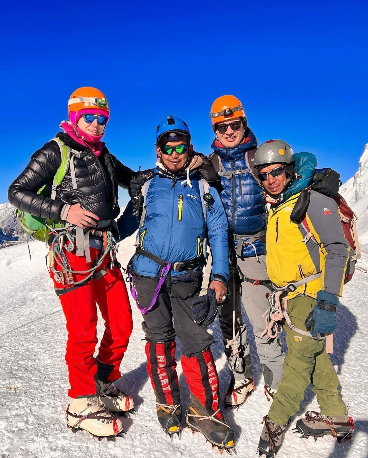
Island Peak, Mera Peak and Lobuche East are the three most climbed trekking peaks in Nepal, together drawing several thousand climbers every year. All ten peaks below sit between 5,500 m and 6,600 m, are managed under the Nepal Mountaineering Association (NMA) permit system, and are climbed with a licensed climbing guide.
A trekking peak combines a classic Himalayan trek with a short, guided summit climb. Most need basic skills with crampons, an ice axe, fixed ropes and a jumar, plus good fitness and proper acclimatization. They are the natural next step for trekkers who have done Everest Base Camp or the Annapurna Circuit.
|
Rank |
Peak |
Height |
Region |
Approx. climbers per year |
Difficulty (Alpine grade) |
Typical trip length |
|---|---|---|---|---|---|---|
|
1 |
Island Peak (Imja Tse) |
6,189 m |
Everest |
2,000–3,000 |
PD+ |
15–19 days |
|
2 |
Mera Peak |
6,476 m |
Everest (Hinku) |
1,200–2,000 |
F / PD |
16–20 days |
|
3 |
Lobuche East |
6,119 m |
Everest (Khumbu) |
1,000–1,500 |
PD+ / AD- |
15–18 days |
|
4 |
Yala Peak |
5,500 m |
Langtang |
300–600 |
F+ |
10–13 days |
|
5 |
Pisang Peak |
6,091 m |
Annapurna (Manang) |
200–400 |
PD+ |
15–18 days |
|
6 |
Chulu West & East |
6,419 m / 6,584 m |
Annapurna (Manang) |
200–400 combined |
PD / AD |
17–20 days |
|
7 |
Tharpu Chuli (Tent Peak) |
5,663 m |
Annapurna Sanctuary |
150–300 |
F / PD |
12–15 days |
|
8 |
Pokalde (Dolma Ri) |
5,806 m |
Everest (Kongma La) |
100–200 |
F / PD |
14–17 days |
|
9 |
Larkya Peak |
6,249 m |
Manaslu |
50–150 |
PD |
18–21 days |
|
10 |
Kyajo Ri |
6,186 m |
Everest (Gokyo valley) |
50–150 |
AD |
16–18 days |
Climber numbers are approximate estimates based on long-term trends and operator experience; the NMA does not publish an easy annual breakdown per peak. Grades use the Alpine system: F = easy, PD = moderately difficult, AD = fairly difficult.
Island Peak is Nepal's most climbed trekking peak and the classic first 6,000 m summit. It rises from the Imja Valley above Chhukung, where it looks like an island in a sea of ice, which is how Eric Shipton's 1951 team named it.
|
Fact |
Detail |
|---|---|
|
Height |
6,189 m (20,305 ft) |
|
Region |
Everest (Khumbu), Sagarmatha National Park |
|
Grade |
PD+ (moderately difficult) |
|
Start / end |
Lukla (2,860 m) |
|
Base Camp |
~5,087 m |
|
High Camp (optional) |
~5,600 m |
|
Trip length |
15–19 days |
|
Summit day |
10–14 hours round trip |
|
Best seasons |
April–May, October–November |
|
First ascent |
1953, by members of the British Everest expedition, including Tenzing Norgay |
|
Approx. climbers per year |
2,000–3,000 |
Most itineraries follow the EBC trail through Namche Bazaar, Tengboche and Dingboche, then turn east to Chhukung. Many groups climb EBC and Kala Patthar first to acclimatize before crossing to Island Peak Base Camp.
Summit day usually starts around 1–2 am. A rocky gully leads to the glacier, where climbers rope up and cross crevasses, sometimes on ladders. The crux is a 100–150 m snow and ice headwall of about 45–50°, climbed on fixed rope with a jumar. A narrow, exposed ridge then leads to the summit.
Climbers need to be comfortable with crampons, an ice axe, jumaring and abseiling. A pre-climb training day at base camp is standard.
Mera Peak is the highest trekking peak in Nepal and technically the easiest of the big three. Its summit shows five of the world's six highest mountains, which makes it one of the best viewpoints in the Himalaya.
|
Fact |
Detail |
|---|---|
|
Height |
6,476 m (21,247 ft), Mera Central |
|
Region |
Hinku Valley, Makalu-Barun / Everest region |
|
Grade |
F / PD (easy to moderately difficult) |
|
Start / end |
Lukla (2,860 m) |
|
Key pass |
Zatrwa La (~4,610 m) |
|
Base Camp |
Khare (~5,045 m) |
|
High Camp |
~5,780 m |
|
Trip length |
16–20 days |
|
Summit day |
8–10 hours round trip |
|
Best seasons |
April–May, October–November |
|
First ascent |
1953, Col. Jimmy Roberts and Sen Tenzing |
|
Approx. climbers per year |
1,200–2,000 |
From Lukla, the route crosses the Zatrwa La into the Hinku Valley, then climbs gently through Kothe and Thangnak to Khare. The fast route over Zatrwa La gains height quickly, so a longer approach through Pangom or extra rest days is safer.
The climb itself is a long, steady glacier walk on moderate snow slopes. Climbers rope up above Mera La and head to high camp on a rock band at about 5,780 m. Summit day is a gentle but tiring snow plod, with a short steeper section near the top that may need a fixed rope.
The real challenge on Mera is altitude, not technique. Good acclimatization, cold-weather gear and steady fitness matter more than climbing skill.
Lobuche East is the most technical of Nepal's three popular Everest-region peaks. It rises directly above the Khumbu Glacier, and many Everest expedition teams climb it for acclimatization before their main climb.
|
Fact |
Detail |
|---|---|
|
Height |
6,119 m (20,075 ft) |
|
Region |
Everest (Khumbu), near Lobuche village |
|
Grade |
PD+ / AD- (moderately to fairly difficult) |
|
Start / end |
Lukla (2,860 m) |
|
Base Camp |
~4,950 m |
|
High Camp |
~5,400 m |
|
Trip length |
15–18 days |
|
Summit day |
10–12 hours round trip |
|
Best seasons |
April–May, October–November |
|
First ascent |
1984, Laurence Nielson and Ang Gyalzen Sherpa |
|
Approx. climbers per year |
1,000–1,500 |
The trek follows the EBC trail to Lobuche village, often with EBC and Kala Patthar done first for acclimatization. Base camp sits a short walk from Lobuche, with high camp on rocky slabs above it.
Summit day begins with rock slabs and scrambling up to the glacier. From there, climbers follow fixed ropes up steep snow and ice slopes of about 45–50°, then a narrow, exposed summit ridge. Most commercial teams stop at the false summit, which is still above 6,000 m; the true summit needs a more exposed traverse.
Climbers should be confident on fixed ropes, with a jumar and abseil device, and comfortable with exposure. Previous experience on Island Peak or similar is a strong advantage.
Yala Peak is the best beginner trekking peak close to Kathmandu. It sits in the Langtang Valley, needs no flight, and fits into under two weeks.
|
Fact |
Detail |
|---|---|
|
Height |
5,500 m (18,045 ft) |
|
Region |
Langtang National Park |
|
Grade |
F+ (easy) |
|
Start / end |
Syabrubesi (~1,460 m), 7–8 hours' drive from Kathmandu |
|
Main village |
Kyanjin Gompa (~3,870 m) |
|
Base Camp |
~4,600 m |
|
Trip length |
10–13 days |
|
Summit day |
7–9 hours round trip |
|
Best seasons |
March–May, October–November |
|
Approx. climbers per year |
300–600 |
The trek follows the Langtang River through forests and Tamang villages to Kyanjin Gompa. Most groups rest here and hike Kyanjin Ri or Tserko Ri for acclimatization.
From base camp, the summit day crosses rocky moraine and slabs, then a short snow slope to the top. Crampons are usually needed on the upper section, and a rope may be fixed in icy conditions. It is a good first peak for trekkers with no previous climbing experience.
Pisang Peak is the most popular climbing add-on to the Annapurna Circuit. Its pyramid shape rises directly above Upper Pisang village in the Manang Valley.
|
Fact |
Detail |
|---|---|
|
Height |
6,091 m (19,984 ft) |
|
Region |
Annapurna Conservation Area, Manang |
|
Grade |
PD+ (moderately difficult) |
|
Start |
Besisahar / Chame by road from Kathmandu |
|
Main village |
Upper Pisang (~3,300 m) |
|
Base Camp |
~4,380 m |
|
High Camp |
~5,400 m |
|
Trip length |
15–18 days (with Thorong La) |
|
Summit day |
8–10 hours round trip |
|
Best seasons |
April–May, October–November |
|
First ascent |
1955, German expedition led by J. Wellenkamp |
|
Approx. climbers per year |
200–400 |
The approach follows the Annapurna Circuit up the Marsyangdi Valley to Pisang. From Upper Pisang, a steep trail climbs through pastures to base camp and on to high camp.
Summit day crosses a glacier and then a steep, sustained snow and ice slope of about 40–45° to the top, usually on fixed rope. The final slope can be icy and exposed, so crampon and jumar skills are essential. After the climb, most groups continue to Manang and over Thorong La to Muktinath.
The Chulu peaks are the bigger, more adventurous alternative to Pisang Peak on the Annapurna Circuit. Chulu East is usually the easier summit, while Chulu West is longer and more technical.
|
Fact |
Chulu East |
Chulu West |
|---|---|---|
|
Height |
6,584 m |
6,419 m |
|
Grade |
PD |
AD- |
|
Region |
Manang, Annapurna Conservation Area |
Manang, Annapurna Conservation Area |
|
Base Camp |
~4,900 m (via Ngawal/Yak Kharka) |
~5,300 m |
|
High Camp |
~5,300–5,500 m |
~5,600 m |
|
Trip length |
17–20 days |
18–21 days |
|
Best seasons |
April–May, October–November |
April–May, October–November |
|
Approx. climbers per year |
200–400 across both peaks |
|
Both climbs branch off the Annapurna Circuit between Pisang and Manang, then head north into the Chulu massif. Plenty of time on the circuit helps with acclimatization before the summit push.
Chulu East usually involves glacier travel and snow slopes of about 35–45° with some fixed rope. Chulu West has steeper, more exposed sections, crevasses and a longer summit day. Both need solid crampon, ice axe and rope skills, and Chulu West suits climbers with previous 6,000 m experience.
Tharpu Chuli, known as Tent Peak, is the climbing peak inside the Annapurna Sanctuary. It is a short, scenic climb for trekkers doing the Annapurna Base Camp route.
|
Fact |
Detail |
|---|---|
|
Height |
5,663 m (18,580 ft) |
|
Region |
Annapurna Sanctuary, Annapurna Conservation Area |
|
Grade |
F / PD (easy to moderately difficult) |
|
Start / end |
Pokhara, by road to Nayapul or Jhinu |
|
Key stop |
Annapurna Base Camp (~4,130 m) |
|
Base Camp |
~4,800 m |
|
High Camp |
~5,200 m |
|
Trip length |
12–15 days |
|
Best seasons |
April–May, October–November |
|
Approx. climbers per year |
150–300 |
The trek follows the ABC trail through Ghandruk or Ghorepani and Chhomrong to Annapurna Base Camp. From there, climbers cross the moraine to Tent Peak base camp and high camp.
Summit day crosses a glacier with some crevasses, then a moderate snow slope and a short ridge to the top. Fixed ropes are used where needed. It suits fit trekkers with basic crampon and rope training.
Pokalde is a short, rocky peak beside the Kongma La pass, and one of the easiest summits in the Everest region. It fits neatly into the Three Passes trek or as a warm-up before Island Peak or Lobuche East.
|
Fact |
Detail |
|---|---|
|
Height |
5,806 m (19,049 ft) |
|
Region |
Everest (Khumbu), between Chhukung and Lobuche |
|
Grade |
F / PD (easy to moderately difficult) |
|
Start / end |
Lukla (2,860 m) |
|
Nearby pass |
Kongma La (~5,535 m) |
|
Base Camp |
~5,000 m, near Kongma La lakes |
|
Trip length |
14–17 days |
|
Summit day |
5–7 hours round trip |
|
Best seasons |
April–May, October–November |
|
Approx. climbers per year |
100–200 |
The approach follows the EBC trail to Dingboche and Chhukung, then climbs toward Kongma La. Base camp sits near the small glacial lakes below the pass.
The climb is mostly rock scrambling along a ridge, with little snow outside winter and spring. A short exposed section near the top may need a fixed rope. After the summit, groups cross Kongma La and descend to Lobuche to continue toward EBC.
Larkya Peak is the climbing highlight of the Manaslu Circuit, rising above the Larkya La pass. It is remote and quiet, and is growing in popularity as more trekkers discover the Manaslu region.
|
Fact |
Detail |
|---|---|
|
Height |
6,249 m (20,502 ft) |
|
Region |
Manaslu Conservation Area (restricted area) |
|
Grade |
PD (moderately difficult) |
|
Start |
Soti Khola / Machha Khola by road from Kathmandu |
|
Key village |
Samagaon (~3,530 m) and Samdo (~3,875 m) |
|
Base Camp |
~4,600 m, near Dharamsala (Larkya Phedi) |
|
High Camp |
~5,500 m |
|
Trip length |
18–21 days |
|
Best seasons |
April–May, October–November |
|
Special permits |
Manaslu Restricted Area Permit, minimum two trekkers with a licensed guide |
|
Approx. climbers per year |
50–150 |
The trek follows the Budhi Gandaki gorge up through Gurung and Tibetan villages to Samagaon and Samdo. Rest days here, with a hike toward Manaslu Base Camp, help with acclimatization.
From Dharamsala, climbers set up high camp and cross glacier terrain to a snow ridge and summit slopes of about 40–45°. Fixed ropes are used on steeper and exposed sections. After the climb, the route crosses Larkya La (5,106 m) and descends to Bimthang and Dharapani.
Kyajo Ri is a quieter, more technical Everest-region peak above the Gokyo Valley. It was opened for climbing in 2002 and suits climbers who want a real alpine route away from the crowds.
|
Fact |
Detail |
|---|---|
|
Height |
6,186 m (20,295 ft) |
|
Region |
Everest (Khumbu), west of Machhermo |
|
Grade |
AD (fairly difficult) |
|
Start / end |
Lukla (2,860 m) |
|
Key village |
Machhermo (~4,470 m) |
|
Base Camp |
~4,550 m |
|
High Camp |
~5,500 m |
|
Trip length |
16–18 days |
|
Summit day |
10–12 hours round trip |
|
Best seasons |
April–May, October–November |
|
Approx. climbers per year |
50–150 |
The trek follows the Gokyo trail through Namche Bazaar, Dole and Machhermo. From Machhermo, a side valley leads west to base camp in a quiet yak pasture.
The route climbs rocky ridges and slabs to high camp, then a glacier and steep snow and ice slopes on fixed ropes to the summit ridge. Some rock sections need scrambling. This peak is best for climbers with previous 6,000 m or alpine experience.
Match the peak to your experience: start with an easy summit, then move up to a technical one. The table below is a quick guide.
|
Your level |
Best peaks |
Why |
|---|---|---|
|
First summit, no climbing experience |
Yala Peak, Tharpu Chuli, Pokalde |
Short, easy snow or rock routes with low technical demand |
|
Strong trekker, first 6,000 m peak |
Mera Peak, Island Peak |
Popular, well-supported routes with training at base camp |
|
Some rope and crampon experience |
Lobuche East, Pisang Peak, Chulu East, Larkya Peak |
Steeper slopes, exposure and longer summit days |
|
Experienced alpine climber |
Chulu West, Kyajo Ri |
Technical mixed terrain and remote routes |
Spring (April–May) and autumn (October–November) are the main climbing seasons for all ten peaks. Autumn brings the clearest skies; spring is slightly warmer with more snow on the routes. Winter is possible on lower peaks but very cold, and the summer monsoon (June–September) brings cloud, rain and landslide risk.
Nepal Trekking Trail, operated by Actual Adventure, runs guided climbs on all of these peaks with experienced climbing guides and Everest-region specialists. Contact our team to plan the right peak for your experience, season and schedule.
Discover more articles that match your interests! Explore these similar blogs packed with insights, tips, and stories to keep you inspired.