
Annapurna Circuit Trek For Beginners: A Complete Guide
By Nepal Trekking Trail On 02 Oct 2026

Quick Contact
By Nepal Trekking Trail On 02 Oct 2026
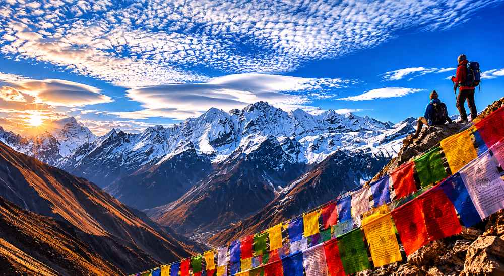
Yes, a beginner who is reasonably fit can complete the Annapurna Circuit, but it is a demanding first trek. The trail needs no climbing skills and teahouses line the route; the real challenge is altitude, with Thorong La Pass at 5,416 m and walking days of 5 to 8 hours.
This guide explains what to expect, a sample itinerary, how to handle altitude, how to train, what to pack, and what to know about permits and this autumn's conditions.
|
Detail |
What to expect |
|---|---|
|
Duration |
10–21 days depending on pace; 15–18 days is a comfortable beginner pace |
|
Distance |
About 160–230 km, depending on where you start and finish |
|
Highest point |
Thorong La Pass, 5,416 m (17,769 ft) |
|
Walking per day |
5–8 hours |
|
Difficulty |
Moderately challenging; suitable for first-time trekkers with preparation |
|
Best seasons |
Spring (March–May) and autumn (September–November) |
|
Accommodation |
Teahouses along the whole route |
|
Main risk |
Altitude sickness, plus cold and snow near the pass |
Sources for these figures: Best Heritage Tour and Nepal Trekking Experts.
The route is well-marked and passes through villages every few hours, so you never need to camp or carry food for the whole trek. You also walk through a huge variety of scenery: subtropical rice terraces at the start, pine forest and Gurung and Manangi villages in the middle, the dry high-altitude Manang valley, and finally the arid Kali Gandaki valley near Muktinath and Jomsom.
Because the ascent is gradual and itineraries include acclimatisation days, a beginner who goes slowly and listens to their body has a good chance of reaching the pass. Guides and porters are easy to hire, which makes a first trek much safer and more enjoyable.
This is a typical slow-paced plan. Altitudes are approximate and vary slightly by source and route; your guide may adjust it. The key rule is to gain no more than about 500 m of sleeping altitude per day above 3,000 m, with rest days at Manang and, if you can, Chame or Pisang.
|
Day |
Route |
Sleeping altitude (approx.) |
Notes |
|---|---|---|---|
|
1 |
Kathmandu to Besisahar to Bahundanda or Syange |
1,300–1,100 m |
Long drive; easy start |
|
2–3 |
Tal, Dharapani, Chame |
1,700–2,700 m |
River valley, forest, first views |
|
4 |
Chame to Pisang |
3,190 m |
Pine forest, Annapurna II views |
|
5 |
Pisang to Manang (high or low trail) |
3,540 m |
Choose the high trail only if you feel well |
|
6 |
Rest day in Manang |
3,540 m |
Acclimatisation hike to Gangapurna Lake or Ice Lake viewpoint |
|
7 |
Manang to Yak Kharka |
4,018 m |
Short day, climb high, sleep low |
|
8 |
Yak Kharka to Thorong Phedi |
4,450 m |
Steep section; start eating and drinking carefully |
|
9 |
Cross Thorong La (5,416 m) to Muktinath |
3,760 m |
Long day: 7–10 hours, start 3–4:30 am |
|
10 |
Muktinath to Kagbeni or Jomsom |
2,810–2,720 m |
Windy Kali Gandaki valley |
|
11+ |
Jomsom to Pokhara (fly or drive) |
820 m |
Return and rest |
You can spread this over more days by adding a second acclimatisation day or stopping at High Camp instead of Thorong Phedi. Everest Trekking Routes notes that Thorong Phedi (4,450 m) gives better sleep, while High Camp (4,880 m) shortens the crossing day but is harder at night.
The toughest parts are the climb from Manang to Thorong Phedi, the pass day itself, and the knee-punishing descent to Muktinath. Walking days of 5 to 8 hours add up, so stamina matters as much as peak fitness.
Plan on 7 to 10 hours in total. Trekkers start between 3:00 and 4:30 am because afternoon winds on the pass can reach 60 to 80 km/h. From Thorong Phedi the ascent is about 966 m of steep switchbacks, followed by a descent of roughly 1,600 m over 8 to 10 km to Muktinath. At the top there is only 50 to 55 percent of the oxygen you breathe at sea level, so go slowly and rest often.
Weather is the other risk. In October 2014 a cyclone-driven storm dropped nearly 1.8 m of snow on the pass and killed 43 people. Check the forecast, follow your guide's decisions about turning back, and never cross in a storm.
Speak to a doctor or travel clinic before the trek about altitude medication such as acetazolamide; I'm not giving medical advice here.
Start training at least 2 to 3 months before you fly. Build leg strength with squats, lunges and step-ups, and cardio with running, cycling or swimming. Add weekend hikes with a loaded daypack, working up to 5 to 6 hours on hills. Practise going downhill too, because the descent from Thorong La is hard on knees.
Many items can be rented or bought in Kathmandu or Pokhara, but boots are worth bringing from home.
You need an Annapurna Conservation Area Permit (ACAP) and a TIMS card or equivalent trekking registration. Fees and rules change, so ask your agency or the Nepal Tourism Board for current prices before you book. Keep copies, as checkpoints along the route check them.
A licensed guide, and a porter if you can, is strongly recommended for a first trek. They handle route finding, lodging, pacing, weather decisions and emergencies. Guided packages for the circuit are quoted from roughly USD 630 for a short version to USD 795 for a 16-day full version in one operator's listing, which shows how widely prices vary with inclusions.
Autumn (September to November) and spring (March to May) have the most stable weather, clearest views and moderate temperatures. October and early November are the busiest, so book lodges early. Expect snow or ice near the pass even in peak season, and winter and monsoon treks are much harder.
Yes. The Annapurna region, including Manang and Mustang, was not affected by the 26 August 2026 flood in Rasuwa, so autumn 2026 treks can go ahead. Still, road conditions can change, so confirm access and bridges with your operator before you travel.
Can a complete beginner do the Annapurna Circuit? Yes, if you are healthy, train for 2 to 3 months and take a slow itinerary with a guide. You do not need technical climbing experience.
How many days should a beginner allow? About 15 to 18 days gives a comfortable pace with rest days. Shorter 10 to 12 day versions exist but leave less time to acclimatise.
What if I get altitude sickness? Stop ascending and rest. If symptoms do not improve or get worse, descend. Severe cases need evacuation, so insurance with helicopter cover is essential.
Is there a shorter alternative? Annapurna Base Camp and Poon Hill are lower and shorter, and a good way to test how you handle altitude.
Which direction is best? Anticlockwise, from Besisahar toward Thorong La and Muktinath, is recommended because it gives better acclimatisation.
The Annapurna Circuit is one of the great treks and is achievable for a prepared beginner. Train well, go slowly, respect altitude and weather, and trek with a licensed guide. Plan a flexible itinerary with spare days for the pass.
Want help planning your first circuit? Contact a licensed local operator for a tailored itinerary and current route conditions.
Discover more articles that match your interests! Explore these similar blogs packed with insights, tips, and stories to keep you inspired.